|
Paul Marinsky METR 2021 Resource
|
|
LABORATORY EXERCISE #1
|
|
48-Hour Forecast Location: ICT (Wichita, Kansas) Valid: Wednesday 090128/1200 thru Friday 090130/00Z
More tranquil weather in store for region for the remainder of the week…
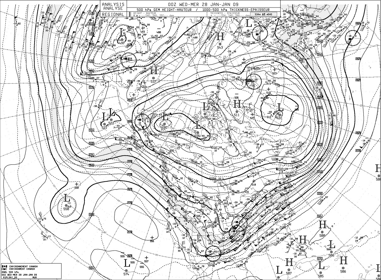
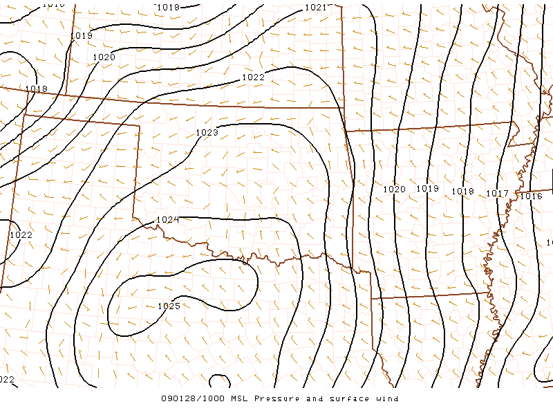
Positively tilted mid-level trough finally making its push through the plains...per 28|00 hemispheric data..enhanced and difax H5 heigh/thickness blend...CAA, evident...continuing to usher in much drier air as influenced by northwesterly flow...Amplified pattern currently centered over the pacific should preclude any unsettled changes over the next few days as it continues to slowly build eastward behind the trough which should all but exit our region through the early morning...cut-off low idly awaits well off the California coast...could prove to be next forecast focus for southwest region and pacific coast by early next week...06-NAM reasonable suggesting weak mid-level short wave will quickly skip through the region through the period...second wave approaches by Friday...at the surface...much of the eastern half of Kansas currently under the influence of sfc high pressure centered over north central TX...the high pressure should push eastward out of the area throughout the day allowing sfc winds to turn more to the ssw; however, a weak surface trough appears evident over the western high plains...this feature is forecast to move through in response to its mid-level counterpart...veering sfc winds more northerly initially before the flow becomes slightly more backed again with the eastern propagation of this sfc trough...increasing sfc westerly flow behind the trough will be the focus for increasing warmer temperatures across the region…
marinsky
Numerical KICT 090128 |12Z thru 090130|00
Wednesday Mostly sunny Low: — High: 33 Wind: SW 8-12 knots Gusts: none Precip: 0.00
Thursday Mostly sunny Low: 22 High: 38 Wind: W 11-14 knots Gusts: +6 kt Precip: 0.00
________________________________________________________________________________________________________
________________________________________________________________________________________________________ Assignment notes:
Hemispheric (2): 28|00 500hpa DIFAX from Environment Canada 28|00 500hpa hemispheric data from HOOT
Synoptic (1): 0600 North-American Model (06Z-NAM Guidance) linked from HOOT
Mesoscale (1): surface contour depiction from SPC
________________________________________________________________________________________________________ |