Reference 8 - Radar: Doppler Radar, NEXRAD WSR-88D


In this lab, we will look at radars: how they are used in meteorology, what types are being used, and how to read radar images. This lab will once again involve you going to other web sites to read about radars in more detail.

Basics of Radar

The radar creates an electromagnetic energy pulse which is focused by an antenna and transmitted through the atmosphere. Objects in the path of this electromagnetic pulse are called targets.

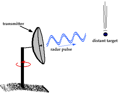
Targets can be anything such as rain drops, snowflakes, hailstones, and even birds and insects. When the pulse hits the targets they scatter the electromagnetic energy. Some of that energy is scattered back toward the radar.
The receiving antenna (which is normally also the transmitting antenna) gathers this back-scattered radiation and feeds it to a device called a receiver.

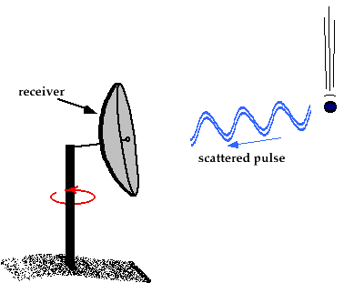
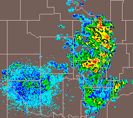
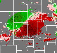
By looking at how much of the scattered energy is returned to the radar, we learn the intensity (or size) of the object that the radar beam hit. By also looking at how long it took the signal to go out and then return, we can figure out how far away the object that was hit is. By plotting both of these calculations, we get a radar image.

NEXRAD (WSR-88D)

NEXRAD (or NEXt generation RADar) is the current radar being used by the National Weather Service. It was developed in the 1970-80's an were being put to use about a decade ago. The picture on the left shows the typical tower in which the NEXRAD radars reside.

The radar dish, similar to the cartoons above, spins around sending and recieving signals. It then tilts upward slightly to a different "elevation angle" and gathers more information. This is repeated a couple more times until a full "volume scan" (or a complete picture of the atmosphere) is gathered. This entire process takes about 6 minutes to be accomplished.

To find out more about NEXRAD, read the following site:

Reflectivity Images

From the above discussion, we learned how the returned beam from scattering can be plotted to give us an image of the atmosphere. This is plotted as a reflectivity image. The image to the left shows a typical reflectivity image.

The color scale for reflectivity images differ depending on where the data is coming from, so you must always look at the key to the side of the image (which is not shown on this image). The majority of the time, light returns (light rain, light snow) will be blue, moderate returns (rain, heavy snow) will be green, heavy returns (heavy rain) will be yellow and red, and extreme returns (hail) will be purple or white. This scale is measured in dBz (or decibles) and has a range from 0 to about 80. Note: This is the case in precipitaion mode. Dry air mode will usually have different colors.

To learn more about reflectivity, see the Dr. Dewpoint site listed at the bottom of the lab.

Velocity Images

Wind velocity information can also be attained from the signals gathered by the radar. This information is very useful for severe weather to located areas of circulation within the clouds.

The image on the left is a typical (non-severe) velocity image. The red colors indicate winds going away the radar, with darker winds being higher wind speeds. The green colors indicate winds coming towards the radar, with darker green colors indicating higher wind speeds.

As we can see in the image, we have a northwest wind, because the green colors are to the northwest of the radar.

Web Sites

Here are some sites to get radar data. There are better sites, but these listed sites are free (or the passwords are given).

To learn more about radars and thier interesting phenomena, check out these sites: