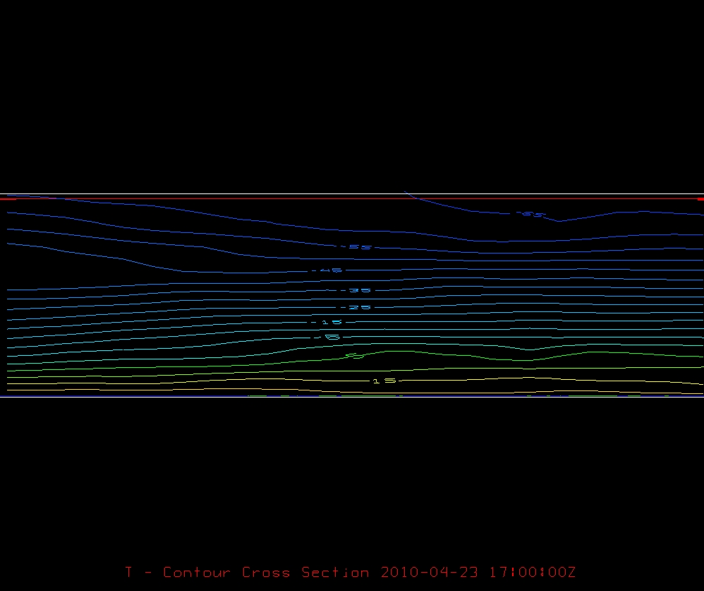
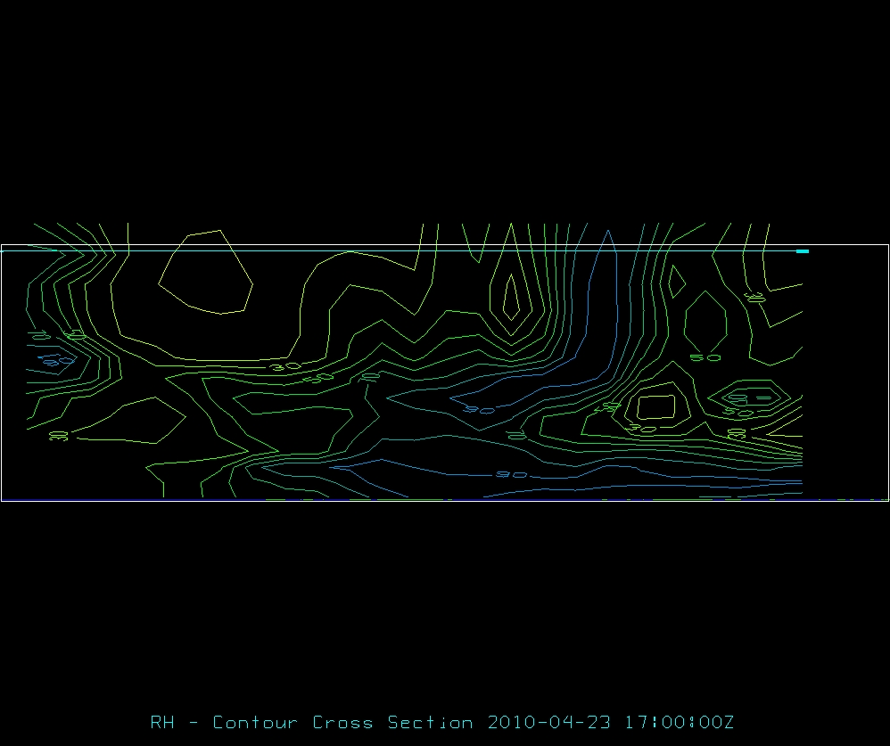
c) You can tell where the cold front is by looking at the 3D cross section charts of Temperature and Relative Humidity across the area in question. The temperature chart shows that the temperature is higher with height to the East, indicating that that region is in a warm air mass, and indicating that the West is in a cold or cooler air mass. The relative humidity chart shows that there is more moisture at the surface to the East and less moisture to the West, again indicating that there is a cold front to the West, that is advancing to the East. The front seems to fairly well defined, especially when looking at the relative humidity chart, as there is an obvious "jump" in moisture as you move East. Convection seems to be occuring about halfway between the bounds of our border, probably somewhere near the Texas/Louisiana border because it is evident that the relative humidity is very high in this region, both aloft and at the surface indicating that moisture is present in the upper atmosphere that has most likely fallen as rain and giving the surface high relative humidities.