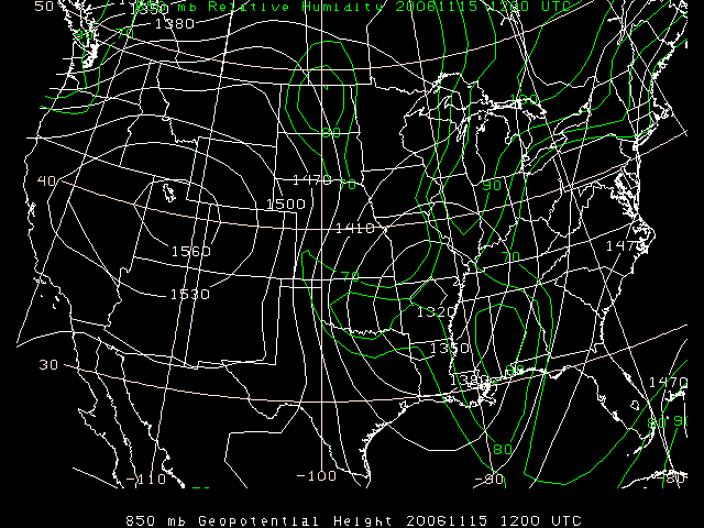
1.Based on the 850 mb map, where might you expect it to be windy? Why?
It appears to be windy in Kansas, Oklahoma, and in the Northwest United States. This is due to the fact that the geopotential heights are close together in these areas.
2.Based on the 850 mb map, and ignoring the moisture in the Dakotas, what type of advection (moist or dry) do you think is occurring over Oklahoma? Why?
Although moist air at the time is sitting over Oklahoma, dry air advection is occurring because the low pressure system is moving the moisture out of the area from West to East.
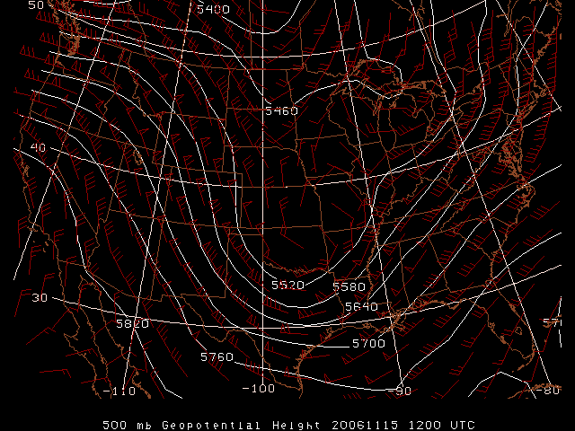
3.Use the 500 mb geopotential contours and wind barbs to identify the location of the trough axis and center of "low pressure".
The trough axis runs up through Texas, Oklahoma and Kansas and has a slightly positive tilt. The center of low pressure appears to be on the southern part of the Kansas/Missouri border.
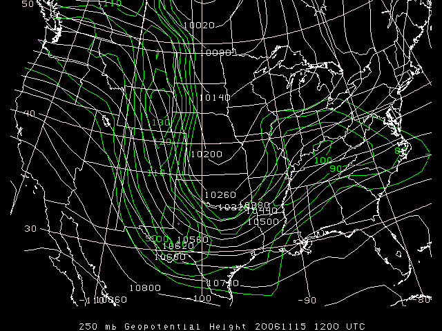
4.Use the 250 mb map to compare the position of the upper trough to that of the mid-and low-level troughs. Do you think the 250 mb trough will dig or lift? Why?
I believe the 250 mb trough will dig, since the winds are significantly stronger on the upstream side of the trough.