Computer Assignment #12
This image is a loop of the AVN model's absolute vorticity and 500
mb heights from 0000 UTC on April 12, 2004 to 0000 UTC on April 13, 2004.
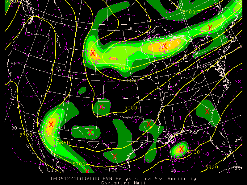
Interesting weather could be found everywhere there is a vorticity max,
as indicated by the red X's. The brighter yellow the area around the X is,
the stronger the vorticity max is. Since the vorticity max's are basically
moving with the wind (which can be seen from the height contours),
positive vorticity advection is found in front of each vorticity max,
which means that in front of each vorticity max there is a region of
divergence aloft that creates surface convergence, surface pressure falls,
rising motion, and a surface low. Therefore in front of each
vorticity max, there is probably an area of clouds and rain. The most
interesting weather on this image is probably occuring in central
Oklahoma, in Michigan, and in Lousiana, based on the final frame of
the looped image.