A general footnote of storm chasing is that most chasers see tornadoes about every 1 in 10 chases. On our 10th chase of the 2001 season, the law of averages came through and we saw 3 tornadoes as well as a fourth funnel cloud.
We arrived in Shamrock at 5pm to get gas, and we checked radar from Amarillo Channel 10 News station on the television inside Phillips 66 and saw 3 major storms in the area, one each north and south of Amarillo, and one further to the south. OU chasers Danny Cheresnick and Jeff Basara were checking radar on the TV and headed out west as well. Oscar and I set out from Shamrock intending to intercept the southern of the two Amarillo storms as it moved northeast.
|
 However, upon
arriving near
Conway on I-40 we changed our target to the north of the two storms, which was now northwest
of Panhandle, TX moving east. We could see a developing wall cloud in the distance, and drove north to Panhandle, TX,
then took Ranch Road 293 west about 7 miles from town to intercept the wall cloud. We stopped near a house on the road
and had an excellent view of the inflow feeding into the storm. Above our heads were swirling bands of clouds, all
quickly feeding into the updraft as out to the northwest of us was the rotating wall cloud.
However, upon
arriving near
Conway on I-40 we changed our target to the north of the two storms, which was now northwest
of Panhandle, TX moving east. We could see a developing wall cloud in the distance, and drove north to Panhandle, TX,
then took Ranch Road 293 west about 7 miles from town to intercept the wall cloud. We stopped near a house on the road
and had an excellent view of the inflow feeding into the storm. Above our heads were swirling bands of clouds, all
quickly feeding into the updraft as out to the northwest of us was the rotating wall cloud.
|
Tornado 1: F0
At approximately 6:55pm CDT a tornado developed to the north of us and dropped to the ground only to dissapate in a manner of seconds. Oscar initially spotted the tornado and gave out a loud yell! We were only able snap a few quick photographs of it before it dissapated. Total time on the ground was about 30-40 seconds.


Tornado 2: F0
Only 3 minutes later at 6:58pm a rope-like tornado developed to the north of us, and moved quickly east. I was over at my truck turning it off because it had been idleing for over 5 minutes, when Oscar again yelled at me. I ran back to my camera and we photographed this tornado as quickly as we could before it moved out of view behind a house. We drove a few miles east on RR 293 and watched as it dissappeared just as the first funnel, spending maybe 2-3 minutes on the ground at most. We drove back to the junction with RR 207 north of Panhandle, and stopped along side a large convergence of chasers and locals out to view the storms. Up until this point we had only seen a few chase vehicles in the area, but after the two touchdowns and a tornado warning was issued, this area became everyone's target.


Tornado 3: F0
A brief F0 tornado was observed at 7:07pm and was on the ground for less than 1 minute. We did not see this tornado but it was mentioned in the damage survey.
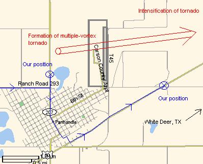 |
 We saw a small multiple vortex tornado develop underneath the wall cloud from this
position, visible for about 30 seconds before becoming obscured by rain. At this point we were southwest of the
wall cloud which was moving due east, so we cut back south through Panhandle, then drove northeast on HW 60,
and as we exitied the city limits at 7:25pm we saw a large wedge tornado! The same tornado that we saw just
earlier had grown from a small multiple vortex tornado to a wedge. It was huge! It
was located about 1 mile to the north of us moving east at roughly 25 mph. In full view we could see the contact point with the ground,
and swirling dirt was brought up into the tornado. It had a brown hue to it because of the dirt being kicked
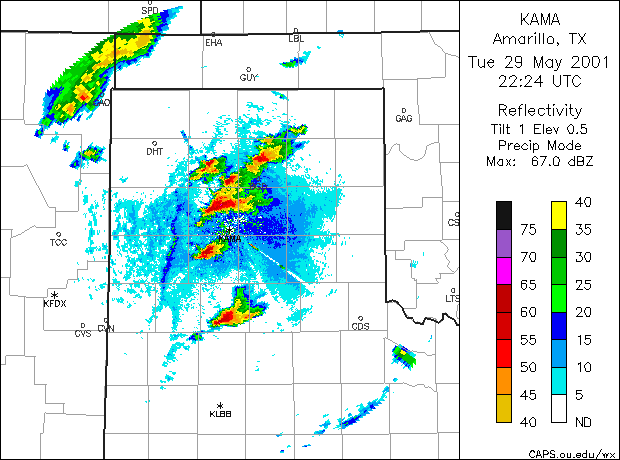
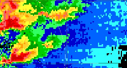
up. The radar image below at 7:20pm shows well defined hook echos on both storms.
We saw a small multiple vortex tornado develop underneath the wall cloud from this
position, visible for about 30 seconds before becoming obscured by rain. At this point we were southwest of the
wall cloud which was moving due east, so we cut back south through Panhandle, then drove northeast on HW 60,
and as we exitied the city limits at 7:25pm we saw a large wedge tornado! The same tornado that we saw just
earlier had grown from a small multiple vortex tornado to a wedge. It was huge! It
was located about 1 mile to the north of us moving east at roughly 25 mph. In full view we could see the contact point with the ground,
and swirling dirt was brought up into the tornado. It had a brown hue to it because of the dirt being kicked
up. The radar image below at 7:20pm shows well defined hook echos on both storms.


|
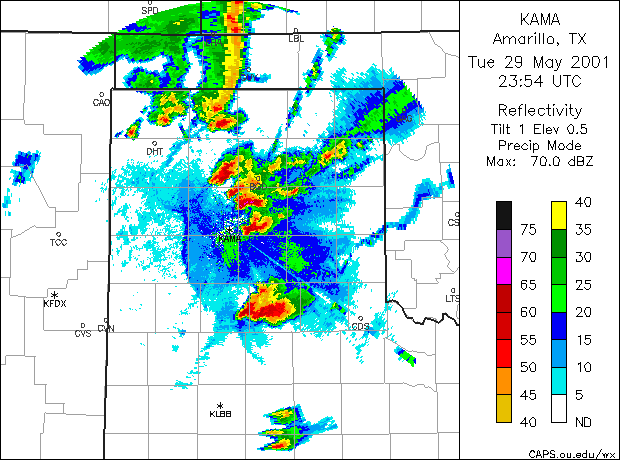
We tracked tornado #4 for about 15 minutes before it wrapped itself in rain and was lost from view to the NE. It eventually crossed HW 60 inbetween Panhandle and White Deer. Only minor structural damage was reported and thankfully no one was injured.
Funnel Cloud #5:
At this time the Texas Highway Patrol was blocking access to HW 60 back behind us, but we turned around and took RR 283 east to try to catch up to the wall cloud and tornado once again. At 7:56pm driving east we could see a thin rope funnel protruding from the side of the updraft and reached far down close to the ground. It was visible only for a minute or so and seemed to rope out and then dissapate. We were unable to photograph this funnel, but count it as the 4th funnel seen during the day, and the 5th overall from the storm.
Driving east along this ranch road we met up with the Dutch Storm Chase Team and shared with them what we had seen so far and heard about their chase. They showed us a few photographs they had taken of the tornado with their digital camera, as well as live radar on their portable TV. We joined the DSCT at this point and continued traveling east, eventually arriving on HW 70 south of Pampa. From this location we could see a detached flanking line to our north, with the updraft visible to the east, as well as mammatus visible on the backsheared anvil. We shot some nice sunset photographs from this location, and set out NE again to try to shoot lightning. After unsuccessfully catching what seemed to be diminishing lightning activity, we split with the Dutch Storm Chase Team at 10:00pm CDT, and they headed back to Amarillo while Oscar and I headed back to Shamrock, TX to refuel and eat.


|
On our drive home we stopped near Hollis, OK to shoot lightning for some time. We also stopped a few more times along the way home, the longest stop being near El Reno, OK where we photographed from underneath an overpass. Constant lightning was striking only hundreds of feet away, and dozens of great cloud-to-ground channels were photographed.


We arrived back in Norman at 6am amid heavy rain and still frequent lightning. I went to work an hour later and then slept later on in the day. Being our first encounter with tornadoes, I think we were very fortunate to see four of them in one day.
In July 2001 I visited and photographed the damamge area of the White Deer tornado.


Other Chase Reports:
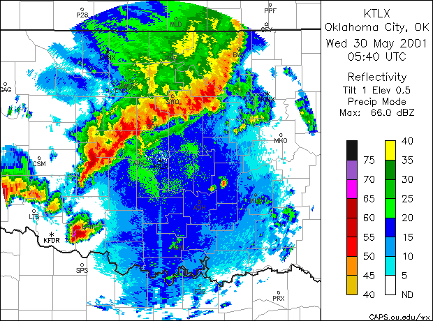
 Radar Data:
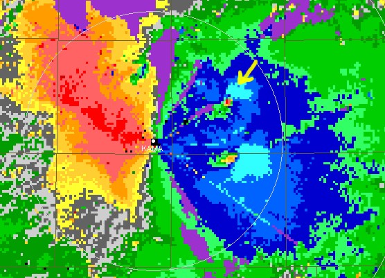
- KAMA storm relative velocity - 7:19pm CDT
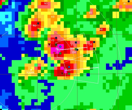
- KAMA composite reflectivity - 7:19pm CDT
- KAMA NIDS data, 6-7pm CDT - Requires WX Scope plugin.
- NWS Damage Survey
- NWS Damage Survey Pictures
- SPC Storm Reports 05-29-2001
- NLDN Data - 05/30 03z-07z
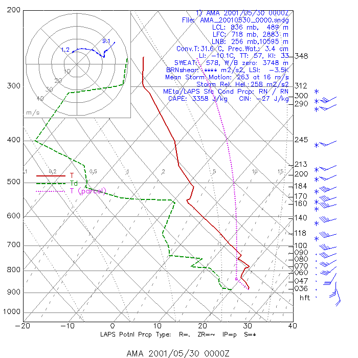
- 00z AMA SkewT-LogP