
|
| |
|
| |
|
| |
|
|
Central Plains, Texas, Denver, Oregon, Arizona, Montana, South Dakota (more) |
|
|
Central Plains, Texas, Northern Plains, Northwest, Great Lakes (more), |
|
|
Southern Plains, United States, NC/NE United States |
|
|
Temperature, Dew Point, Theta-E, Pressure, Wind, Moisture Conv., Lifted Index, CAPE, CIN, Helicity, (more) |
|
|
Mass Divergence, Moisture Divergence, Theta-E, Today's Highs/Lows, Yesterday's Highs/Lows, Mesonet Meteograms |
Regional and National
|
|
|
850 mb, 700 mb, 500 mb, 300 mb, 250 mb, 200 mb |
|
|
850 mb, 700 mb, 500 mb, 300 mb, 250 mb, 200 mb |
|
|
850 mb, 700 mb, 500 mb, 300 mb, 250 mb, 200 mb |
|
|
850 mb, 700 mb, 500 mb, 300 mb, 250 mb, (925 mb) |
|
|
|
|
|
|
|
Oklahoma City, Amarillo, Ft.Worth, Dodge City |
|
|
Oklahoma City, Amarillo, Ft.Worth, Dodge City, (more) |
|
|
Oklahoma City, Amarillo, Ft.Worth, Dodge City, (more) |
|
|
Oklahoma City, Amarillo, Ft.Worth, Dodge City, (more) |
|
|
Oklahoma City, Amarillo, Ft.Worth, Dodge City |
|
|
GOES soundings/IR |
|
|
Sounding Archive |
|
|
|
|
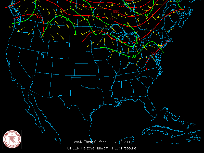
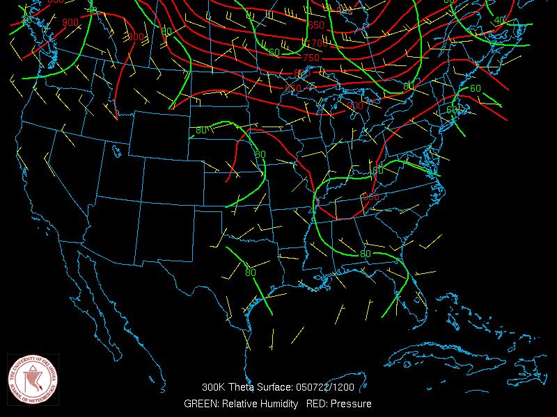
285K, 290K, 295K, 300K, 305K, 310K, 315K, 320K |
|
|
285K, 290K, 295K, 300K, 305K, 310K, 315K, 320K |
|
|
285K, 290K, 295K, 300K, 305K, 310K, 315K, 320K |