04.10.05 Oklahoma/Lincoln Co., OK Supercell
Chase Account
 Tonight
I feel like a proud father that forgot to attend his child's graduation. After
waiting perilously most of the afternoon along the dryline, I finally witnessed
the first cell go up in south central Oklahoma and followed it back home to
Norman, OK. Unfortunately, the supercell eventually dropped a tornado after
sunset near Harrah, OK just northeast of Oklahoma City around 8:30 pm while I
watched from the comfort of my living room.
Tonight
I feel like a proud father that forgot to attend his child's graduation. After
waiting perilously most of the afternoon along the dryline, I finally witnessed
the first cell go up in south central Oklahoma and followed it back home to
Norman, OK. Unfortunately, the supercell eventually dropped a tornado after
sunset near Harrah, OK just northeast of Oklahoma City around 8:30 pm while I
watched from the comfort of my living room.
I began my day at 11:30 am driving through stratocumulus spawn showers along
I-44 on the way to my initial target of Lawton, OK. Once there I
discovered that their Love's wifi access doesn't work but was able to head south
to exit 37 off of I-44 to find wifi at a Spring Hill Marriot Hotel. I analyzed
data on my laptop until 1:30 pm and then decided to head east of Lawton a few
miles to watch for cumulus build-up along the advancing dryline. After an hour
it became apparent that it would take time and patience for the cap to break, as
it took time for the atmosphere to recover from the morning showers and initial
cloudiness.
By 3 pm I made the decision to head even further east in the vicinity of
Duncan, OK. I spent 30 minutes around 4 pm in the small town of Bray, OK
watching some cumulus towers attempt to get their act together, but successfully
watched them fall apart and dissipate off to the northeast. After meandering to
the west to Marlow, OK for a little while I set up camp for 15 minutes just east
of Bray near the intersection of Hwy 29 and 76, ten miles north of Velma, OK.
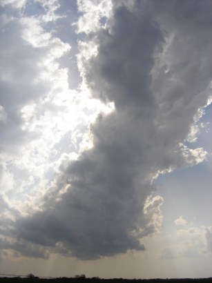
Here I witnessed the cap finally break as the eventually tornadic supercell was
born. (Left) I wish I had a larger lense to show the sheared out extent of this
single updraft that pulsed just off to the southwest of the main supercell.
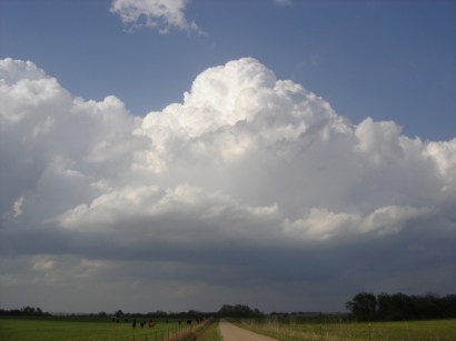
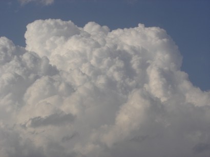
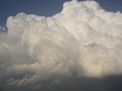
Here are photos of the towering cumulus that finally broke the
cap at 5:15 pm just northeast of the small town of Bray, OK
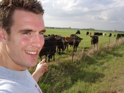
I found some cows to hang out with near Bray to waste the time
waiting for the cap to break!
After enjoying the initiation of the convection I headed north for a better
vantage point. After jogging back east to get on Hwy 76, I went back west at
Lindsay, OK along Hwy 19 and headed north from the small town of Alex, OK. Just
north of Alex I took these photos around 6:30 pm, not really expecting the cell
to continue to increase in strength as it neared Norman.
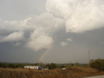
After taking these photos I drove north to catch Hwy 39 east toward Purcell,
OK. Glancing to the north the storm appeared to be getting its act together to I
drove north on a gravel road to get some closer shots. For a period time from
7:20 to 7:25 pm the supercell began to organize a lowered circulation with some
noticeable updrafts along its southern flank.
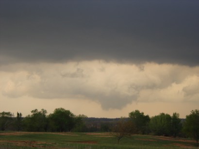
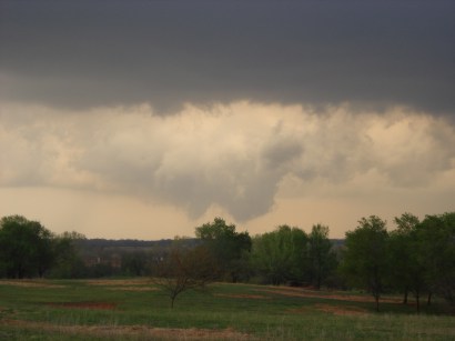

Soon thereafter the lowered base dissipated, but it was just a sign of things
to come for this particular supercell. I drove back toward Norman from here
without any observations of lowered circulations or wall clouds, but once
entering southern Norman from I-35 just after 8 pm there was an ominous new
lowered circulation further to the east. Instead of battling the darkness and
fatigue, I made the decision to head back to my apartment where I was able to
follow the local news wall-to-wall coverage as the supercell strengthened
further and produced two short-lived tornadoes. They were all the more difficult
to identify due to the limited amount of lightning associated with the supercell.
I ventured out not expecting any tornadoes due to unidirectional shear, but
was satisfied to see the birth of the supercell, even though I did not follow it
through to see the tornadogenesis. I'm not a big fan of chasing in the dark
though, so no big loss. Ideally I would've been up in Kansas but that was just
too far to go today and I was afraid of the storms being rain-wrapped. All in
all not a bad chase for going solo all day...much thanks to fellow OU graduate
students Nick Biermann and Eric Holthaus for their nowcasting assistance!
Home
©2005 Nic
Wilson