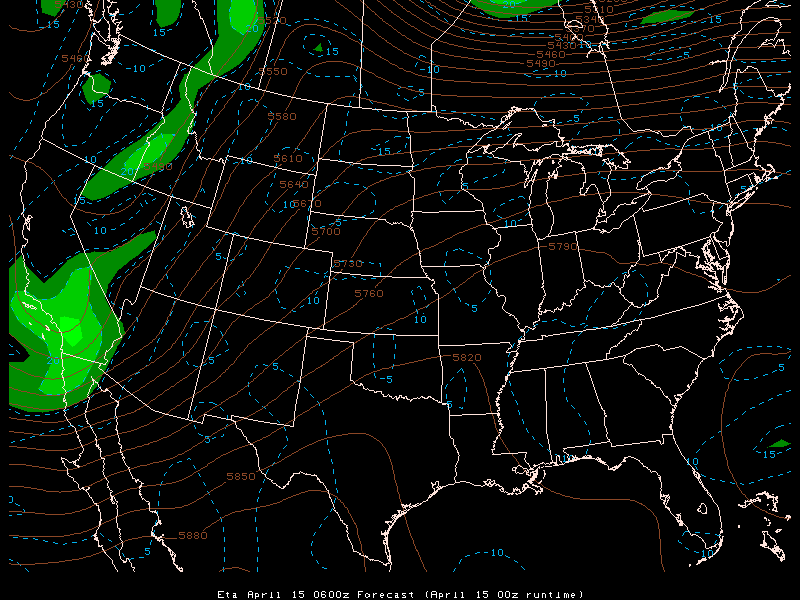
This is a 500mb/vorticity loop of the ETA April 15 00z run for forecast times 0600z Apr 15
to 0600z Apr 16. Its shows a vorticity max moving into NW Oklahoma along with
a low pressure system in western Kansas by the night of April 15. These two
features along with other conditions (eg. dryline or front) could indicate possible severe
weather from western Kansas to western Oklahoma and into the eastern part of the Texas
panhandle, which of course turned out to be the case on this particular day.