Intensification of Alberta Clippers
ALberta Clippers are usually known as light snow producers because of
their lack of moisture. However, if an Alberta Clipper system can
make it across the Appalachian Mountains to the relatively warm,
moisture rich Atlantic Ocean some storms can rapidly intensify.
These storms, now located off the East Coast of the United States,
become known as Nor'easters and can spread haevy snow over New England and
southeastern Canada. This was the case in the great New England
blizzard on February 6, 1978. There have been several other storms
of this type reported including the storm that struck the East Coast
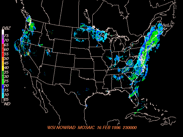
on February 16, 1996. A radar image from this storm is shown below.
In this image you can clearly see the storm stretching from eastern
Canada all the way down through the Carolinas.This storm dumped
large amounts of snow along the coast with reports of up to 10 inches
of snow falling in Virginia.
Source: COMET case study
http://cimss.ssec.wisc.edu/goes/misc/wv/960216_2300_nowrad.gif
Although the strongest storms associated with Alberta Clippers
occur off the east coast, these systems can also intensify when they
encounter moisture over the Great Lakes. In this case, Alberta
CLippers are then capable of producing Lake Effect snow on the leeward
side of the lakes. In this way, Alberta Clippers can be the source of
much of the annual snowfall in the Great Lakes.
Back to Alberta Clippers
Home