 |
 |
 |
|
|
|
As we left campus, a thick veil of "blow-off" from our storm was already
streaming
past us just to the south. After driving under some nice mammatus, past
the cafe from the movie "Twister", and, then, past a sign directing us to
"Wallville" (perhaps Wall-cloud-ville would have been more
appropriate!), things began to get interesting. About 10-15 minutes
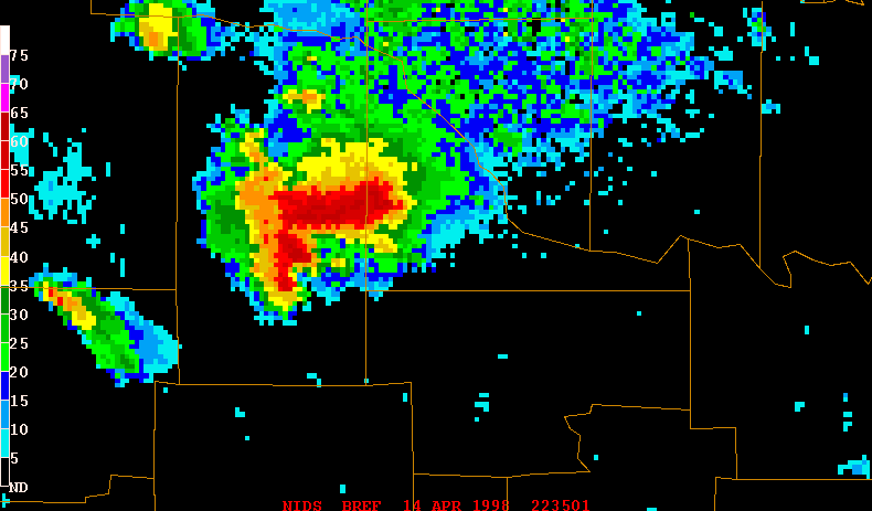
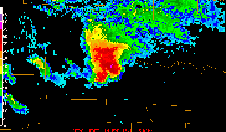
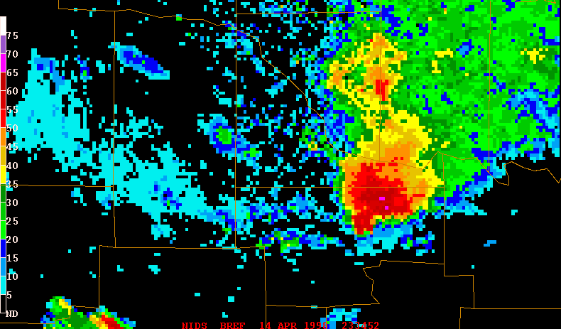
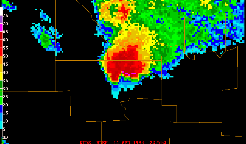
before we arrived in Lindsay, the storm (see KTLX radar images BREF1;
BREF2)
had supposedly produced an unconfirmed tornado near Alex...just to the
west. As we continued to approach Lindsay from the east on OK19,
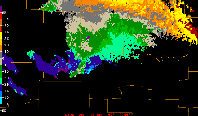
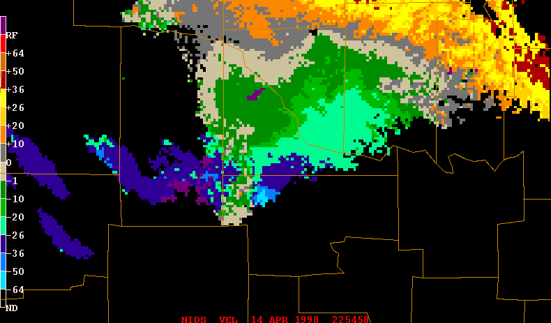
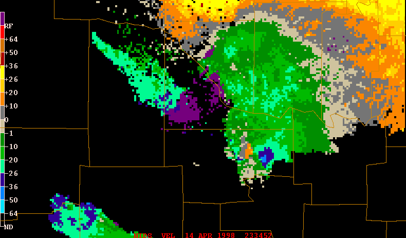
sustained inflow winds from the east/southeast of about 50 mph (see KTLX
radar image BVEL2)
began to kick up thick clouds of dust...lowering visibility in spots to
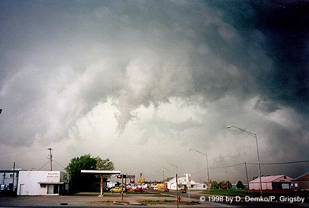
between 50 and 100 feet or so. While stopped at a gas station at the
intersection of Oklahoma Highways 19 and 76, we noted a disorganized area
of elongated rotation/shear (along the edge of the approaching RFD)
extending from the southwest through the northwest...with multiple
"eddies" of smaller-scale rotation embedded within that. For a very brief
time, around 5:50 PM, a very "scuddy", rotating "funnel
cloud" (small, nearly vertical funnel slightly left of center in the
photo) did make an appearance on this shear axis just to the west of
our location along the leading edge of the oncoming RFD. Minutes
afterward, realizing that the RFD was definitely
about to pay our location a glancing blow (see KTLX radar images BREF1;
BVEL2),
we headed south on OK76.
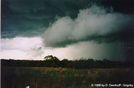
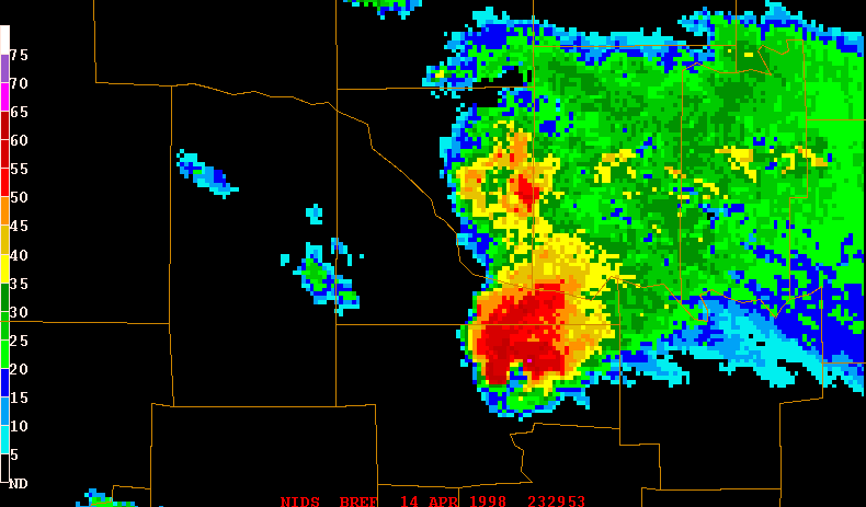
Once a few miles south of Lindsay,
around 6:00 PM, we noted that a somewhat more organized base-lowering
was beginning to congeal just to the south of the, now, bowed-out RFD (see
KTLX radar image BREF1)...some
distance between Lindsay and our position. Moments later, a
ragged wall
cloud made an appearance off to the north-northwest. As the wall
cloud continued moving east over the next few minutes, a weak and visually
diffuse landspout/dust-tube became barely apparent, under the wall cloud,
to the east-northeast of our location. This occurred as the storm began
sucking a fair amount of dust into the updraft.
After the storm moved
east, we continued south on OK76 and eventually left the storm to try
chasing an "LP-type" storm near Duncan, OK. Meanwhile, the first storm (see
KTLX radar images BREF1;
BREF2;
BREF3;
BVEL2)
continued taunting other chasers with pretty impressive structure,
fair rotation, and brief "funnels"...but no confirmed
tornado touchdowns. The rotation just wasn't ever able to tighten up. As
I later learned, talking with some others and looking at UA data from that
evening, it appears that the storm never really "jelled" into a tornadic
supercell probably due to the fact that it didn't fire directly under the
commonly favorable
left-exit region of the jet max. So, with that being the case, other than
briefly seeing nice structure with the LP storm northeast of Duncan later
that afternoon, the chase drew to an end. We returned to Norman just
before 9:00 PM.
Go back to
the chase page...
Go home...