*Radar
[Introduction]
Doppler radars provide abundant observations to monitor and analyze the internal structure of convective storms. These observations have high spatial and temporal resolution and good accuracy. Thus, the assimilation of radar measurements is widely used to initialize convective scale numerical weather prediction models. Ensemble-based data assimilation methods become increasingly popular for directly assimilating radar observations, due to their ability to easily estimate and use flow-dependent covariances.
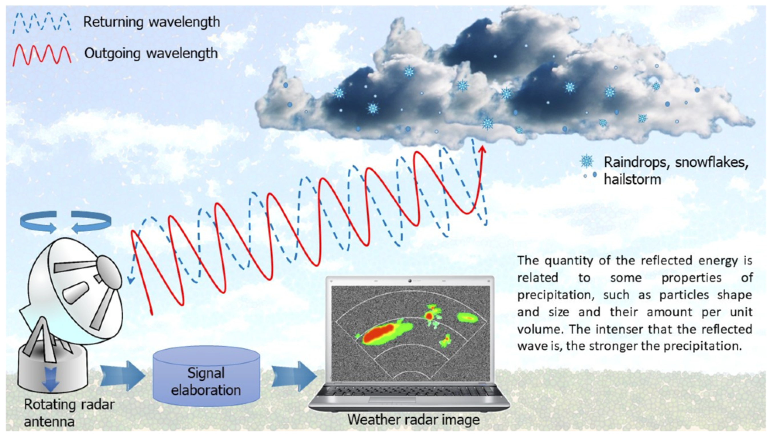
Figure obtained from https://encyclopedia.pub/entry/19513
Significant challenges remain in the proper assimilation of radar observations. MAP offers great efforts within ensemble-based data assimilation to improve radar analyses and subsequent forecasts. Most recent works are highlighted as follows:
| 1.Radar DA frequency | | | 2.Valid Time Shifting (VTS) for radar DA | | | 3.Static BEC | | | 4.Multivariate additive inflation | | | 5.HWT testbed | | |
* ======================================================================== *
Highlights of Recent and Ongoing Research
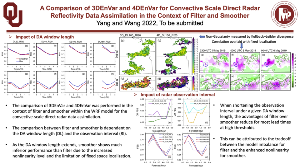
[Radar DA frequency]
From Yang and Wang (2022)
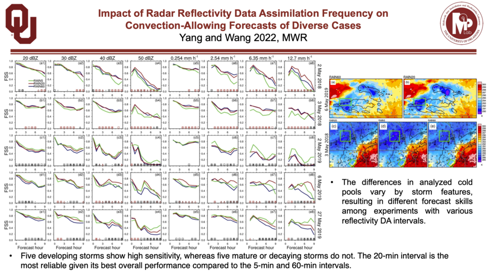
From Yang and Wang (2022; To be submitted)
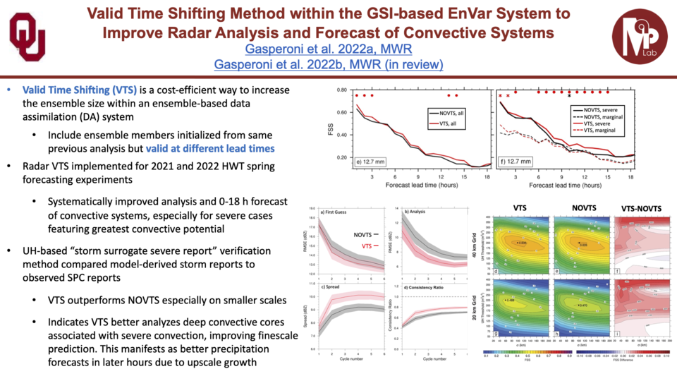
[Valid Time Shifting (VTS) for radar DA]
From Gasperoni, N. A., X. Wang, et al. (2022a); Gasperoni, N. A., X. Wang, et al. (2022b; In Review)
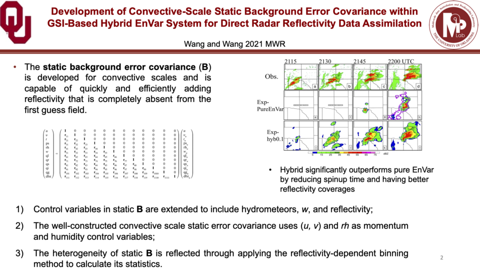
[Static BEC]
From Wang and Wang (2021)
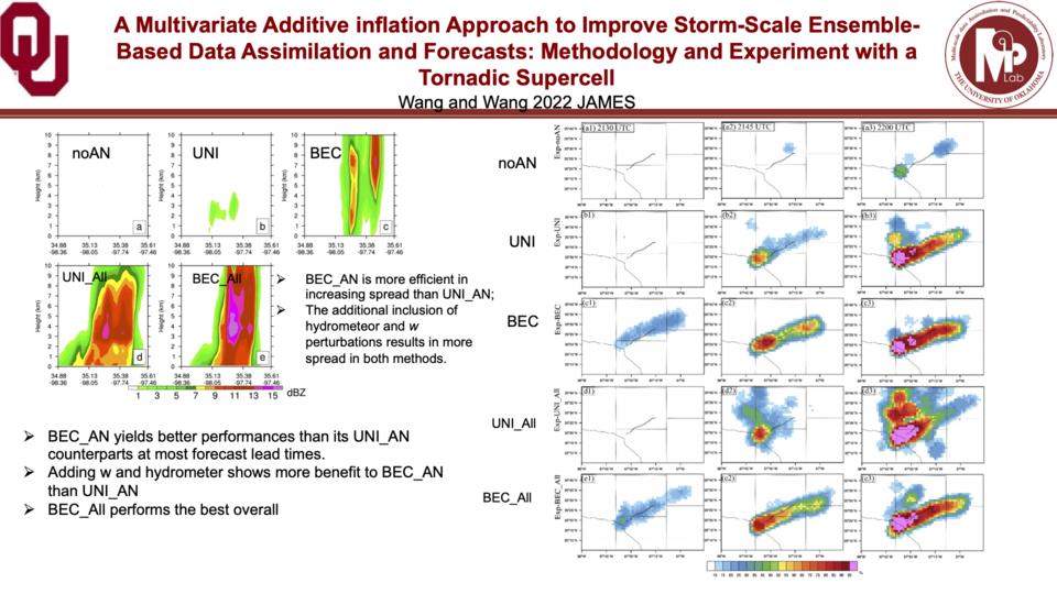
[Multivariate additive inflation]
From Wang and Wang (2022; In Review)
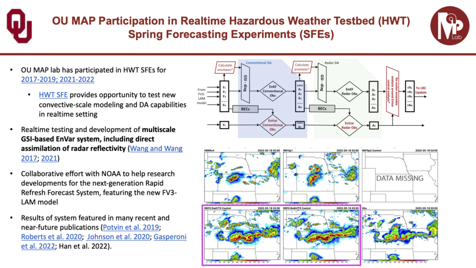
[HWT testbed]
Related links OU MAP Participation in Realtime HWT SFEs; HWT SFE
Related papers Wang and Wang (2017; 2021); Potvin et al. (2019); Roberts et al. (2020); Johnson et al. (2020); Gasperoni et al. (2022a)
*Satellite
[Introduction]
The Advanced Baseline Imager (ABI) onboard NOAA’s GOES-16 geostationary satellite provides continuous observation across the U.S. in the infrared spectrum with spatial resolution of ~2 km and time frequency of ~2 minutes. The unprecedented space and time resolution, and continuous coverage, makes these infrared radiance observations ideally suited to help constrain convective scale features within data assimilation systems. While radar reflectivity observations are limited to precipitating cloud regions, the infrared radiances provide information about mid-level water vapor in the absence of clouds as well as information about non-precipitating clouds.
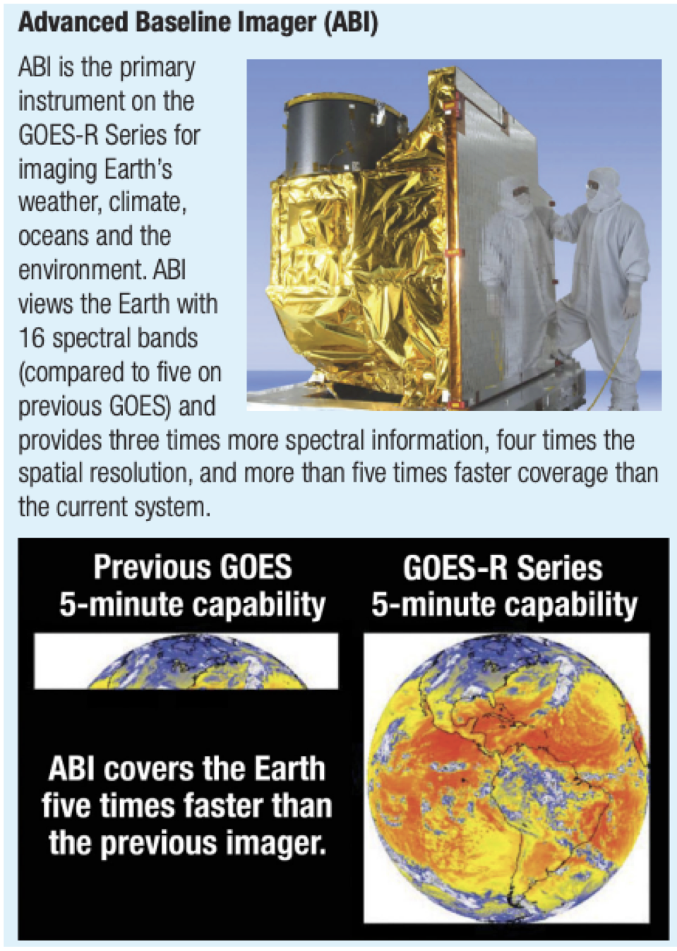
From NOAA GOES-R brochure
MAP lab conducts research aimed at the optimal assimilation of ABI infrared radiance observations, together with conventional and radar observations, in order to improve numerical forecasts of convective systems. Examples of recent and ongoing research on this topic include:
* ======================================================================== *
Highlights of Recent and Ongoing Research
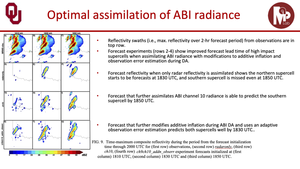
[Optimal DA strategies for maximizing impact of ABI observations on forecast]
From Johnson, A., X. Wang, et al. (2022)
Other related papers Chandramouli, X. Wang, et al. (2022)
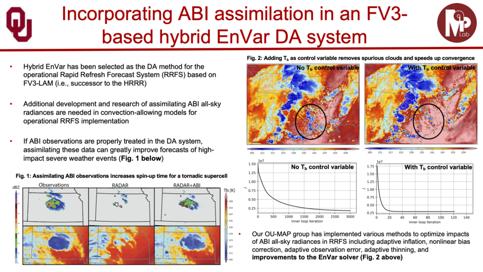
[Incorporating ABI assimilation in FV3-based hybrid EnVAR DA system]
From Degelia, S. K., X. Wang, et al. (2023; In Preparation)
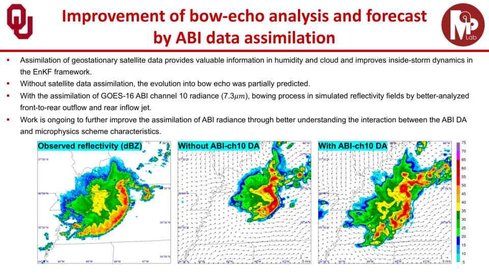
[Understanding interactions between radiance assimilation and microphysics parameterization]
*Other ground based remote sensing observations
[Introduction]
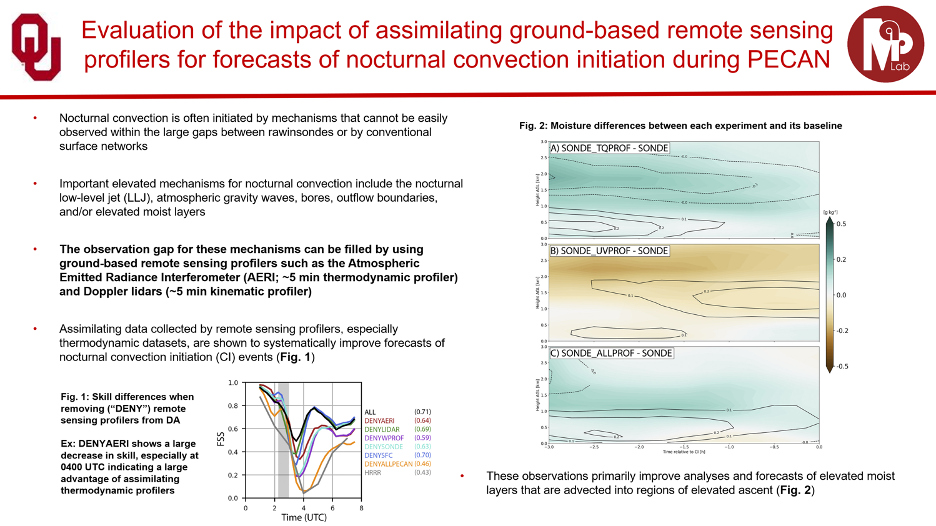
Most severe weather develops and is rooted within the planetary boundary layer (PBL) that extends from the surface to ~1-2 km AGL. However, the PBL is only routinely observed by radiosondes (i.e., weather balloons) that are launched twice a day and spaced by hundreds of kilometers apart. To fill this data gap, researchers have recently begun developing and testing ground-based remote sensing profilers that collect high-frequency (available every ~5 minutes) observations of atmospheric conditions above the surface. These instruments consist of thermodynamic (temperature and humidity) and kinematic (wind) profilers.
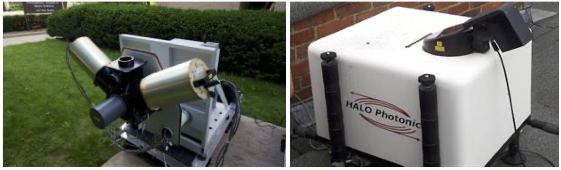
a) Atmospheric Emitted Radiance Interferometer (from SSEC at UW-Madison); and b) a Doppler lidar (from UKRI Chilbolton Observation)
Assimilating these profilers into numerical weather prediction (NWP) models can greatly improve forecasts of high-impact weather events. The MAP lab conducts research aimed at evaluating the impacts of assimilating both thermodynamic and kinematic remote sensing profilers for forecasts of nocturnal convection.
| 1.Impact of assimilating ground-based remote sensing | | |
* ======================================================================== *
Highlights of Recent and Ongoing Research
[Impact of assimilating ground-based remote sensing]
From Degelia, S. K., X. Wang, et al. (2019; 2020)
Other related papers Chipilski, H. G., X. Wang, et al. (2020; 2022)