05.13.05 Crowell, TX Supercell
Storm reports encountered on the chase:
Chase Account
Kenny Tapp, Aaron Kennedy, Shane (current FSU graduate student..OU grad) and I departed Norman around 1pm after Kenny had some delays getting his Blazer fixed at Wal-mart following our flat tire incident the previous day (likely blamed on Friday the 13th bad luck). Our target was the Childress, TX area where a tornado watch had been issued shortly after we hit the road. Backed winds, high levels of CAPE and decent helicity were waiting for us at this target, along with every chaser in the universe that stayed overnight there following the Caprock chase on Thursday. Radar updates on Aaron's sprint phone showed a cell going up in Cottle Co., TX, just south of Childress. We filled up with gas in Quanah, TX and booked it south on HW 6 to get in position for the storm.
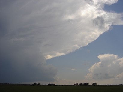
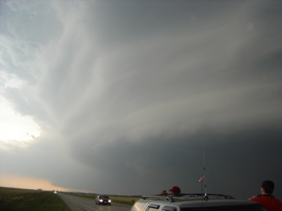
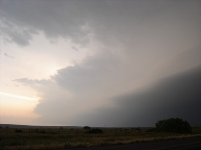
First view of the overshooting anvil from the northeast of the storm at 4:21pm
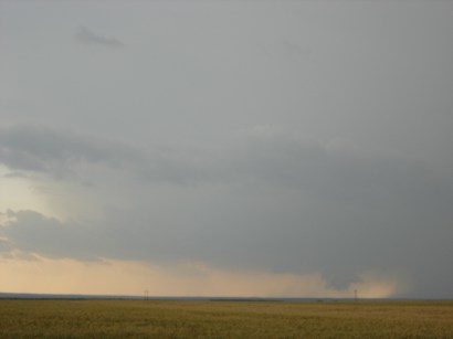
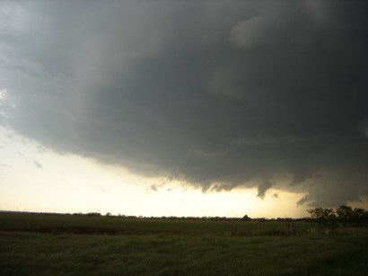
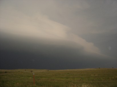
First glimpse of the rain free base at 4:50pm looking west from HW 6
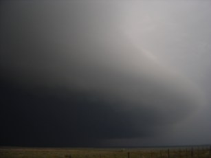
The supercell was looking great on radar with a massive hook echo and intense hail and precipitation core. From our vantage point the main low-level circulation was far to the west but we had an excellent visual on it from perch. Many other chasers were lined up along HW 6 as well to film and photograph the storm as it moved southeast toward us.
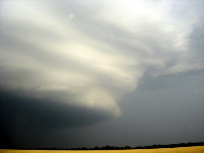
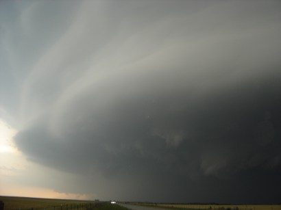
Mammatus visible in the anvil (4:51pm) and the first left split from the main supercell evident to the northwest (4:52pm)
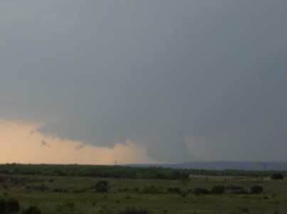
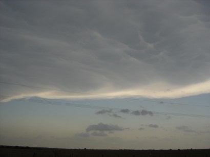
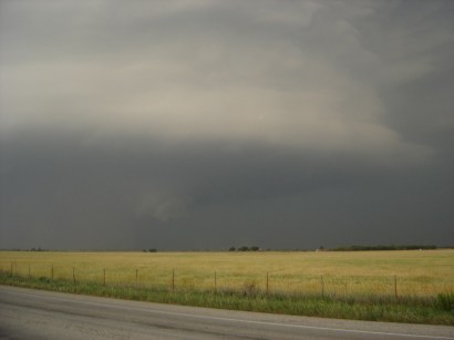
The photos above were taken ~5:15pm looking west when some other chasers reported a small tornado near Hackwell that would correspond with this intense lowering in the storm. We were well east at this point so we could not tell if there was circulation at the ground or not. During this time we continually headed further south along HW 6 to maintain position with the mesocyclone's movement to the southeast. It was entertaining to see the constant flow of traffic as chasers repositioned further down HW 6 in various intervals
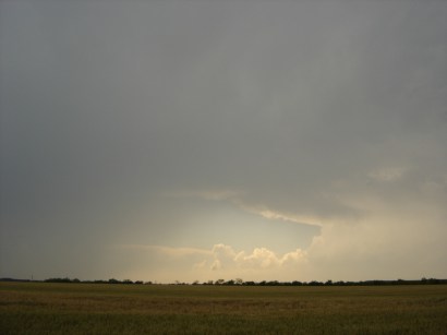
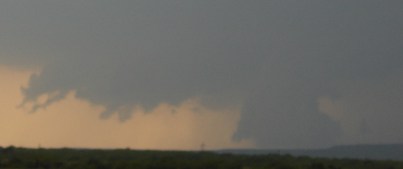
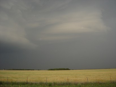
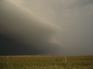
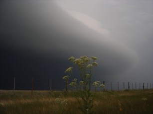
The mesocyclone approaches closer to us with strong inflow and a possible funnel cloud (5:54pm)
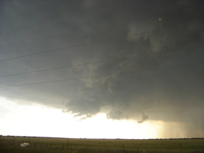
The mesocyclone approaches between 6:06 and 6:16pm with broad circulation noted the folks with Wx Worx over the Ham. Our new favorite term originated this week for the chasers with Wx Worx and limited formal meteorological education....they will now be nicknamed: "Shear circle chasers!" in honor of the yellow circles Wx Worx's algorithm places when detecting velocity couplets
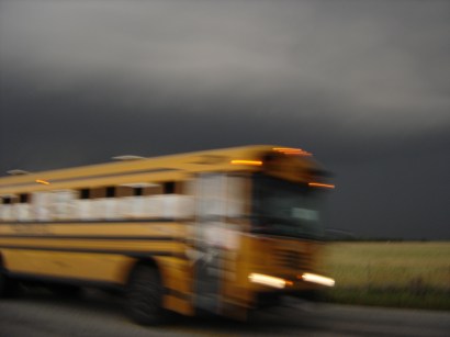
From 6:20 to 6:45pm we repositioned on the storm to avoid the quickly approaching precipitation core and to get out ahead of it to take some storm structure photographs. We headed south along HW 6 through Truscott down to HW 82 and east from Benjamin. During this time several chasers caught a rain-wrapped cone tornado near Gilliland. However, we weren't the only ones that missed as we led a caravan of 20+ chase vehicles, including Josh Wurman's Doppler on Wheels as we headed southeast. The caravan even included a school bus carrying students going to a track meet that had unknowingly gotten caught up in the storm -- they must've wondered what in the heck was going on with all the chasers around!
Josh Wurman's DOW and the caravan of chase vehicles pass us following our reposition to the southeast north of Rhineland on HW 82 (6:48pm)
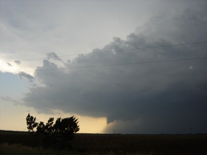
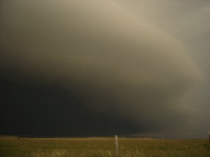
Our new position gave us a breathtaking view of the mesocyclone's structure. The storm looked like a "wedding cake" in the sky (6:51pm)
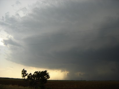
This photo shows the residual lowering from the brief tornado near Gilliland. The mesocyclone had an interesting residual sculpting on its east side as well

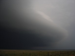
Kenny and his Blazer overlook the supercell around 7pm. The large scale circulation was evident with 40+ knot inflow into the storm
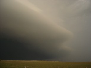
After taking these pictures we hurried to head further southeast to reposition once again as the storm was bearing down on us. We headed east on HW 82 to Seymour where we went south on HW 183/283 to the east side of Throckmorton for the arrival of the gust front. While repositioning we missed a brief gustnado spin-up along the lead edge of the gust front, but we avoided any hail or heavy rain. Apologies to the man driving a pickup truck north on HW 183/283 as we headed south to get into position to photograph the gust front that lost his mattresses he was hauling, we saw one acting as a giant sponge an hour later when we headed back home up HW 183/283 -- the moral of the story is to not haul mattresses without plastic covering when an HP supercell the size of Connecticut is bearing down on you haha. The rest of these photos were taken between 8:07 and 8:22pm and are self explanatory as the gust front approached.
1st photo looking to the east...2nd photo looking to the west
We then headed back east to Throckmorton and back north through the precipitation core of the cell which had thankfully weakened by 9pm. We only encountered some slushy hail and heavy rain. Once we got to Wichita Falls, TX we enjoyed a Pizza Hut dinner. For the third consecutive night we returned to Norman around 1:30am. Will there ever be storms near Norman again? haha. Atleast finals were now over and we could sleep in, praying that the death ridge doesn't set in and eliminate any chasing opportunities before I move to Boulder, CO on May 21st.