|
Chase Accounts 03.21.05 Pharoah, OK Tornado 04.05.05 Tom Bean, TX Squall Line 04.10.05 Oklahoma/Lincoln Co. Supercell 05.08.05 Oklahoma Multicells 05.11.05 Kansas Bust 05.12.05 Floyd Co. TX Supercell 05.13.05 Crowell, TX Supercell 06.02.05 Colorado Supercells Severe
Wx Links Storm Chasing (These
sections are now up and running! Feel free to check them out!)
|
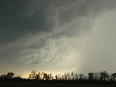
 Friday the 13th Spawns Picturesque HP Supercell Near Crowell, TX
We were treated to the spectacle of the most picturesque supercell to hit the Southern Plains this chase season on Friday May 13th, 2005. The supercell transitioned from classic to high precipitation with incredible amounts of inflow to sculpt its "wedding cake" like mesocyclone that appeared to swallow the entire sky. Two weak and brief tornadoes were reported with the storm. Unfortunately, we missed them due to repositioning necessary due to the unique southeastern storm motion and poor road network in the area. The end of the chase sent us to near Throckmorton, TX where we took photos of the powerful gust front approaching from the north. The full report and pictures can be found by clicking the photo. May 12, 2005: 30 Minutes Too Late for the Caprock Tornadic Supercell
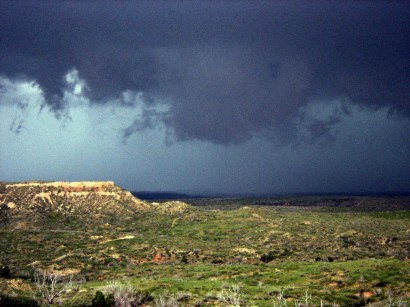
After initially targeting closer to home in northwestern Oklahoma, we rushed southwest to catch the tornadic Plainview, TX supercell that had been churning for 4+ hours. We arrived a half hour too late to catch the 4 tornadoes this vicious storm produced. Numerous chasers had softball sized hail batter their vehicles as it wrapped around a huge half mile F3 tornado it produced near White Plains, TX. After we arrived, wall clouds passed directly over the Caprock, making for a picturesque scene. Click the photo to read my full report and pictures on this exciting chase.
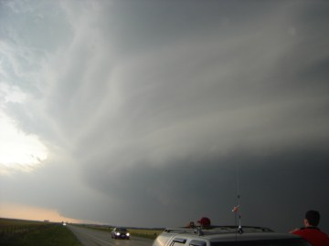
Squall Line Madness in Northern Texas Numerous Hail Reports Across Kansas, Oklahoma and Texas
On April 5, 2005, myself, Eric Holthaus and Renee Curry set out for our target of Durant, OK out ahead of a quickly propagating dryline. Once in Ardmore, OK checking data on my laptop at 2pm we soon realized that the forcing was too linear and there would be no discrete cells and hope for tornadoes. However, we did get to punch thru an intense squall line near the small town of Tom Bean, TX where we sat thru a 15 minute hail storm with up to 0.88 inch hail. You can't consider a day a total loss when you get the chance to phone in a severe storm report. Check out my chase account here. (Photo) A shelf cloud as the squall line approaches from our southwest near Tom Bean, TX. Welcome to Spring 2005! Eleven Tornadoes Kick-Off the Storm Season Across the Southern Plains on March 21, 2005
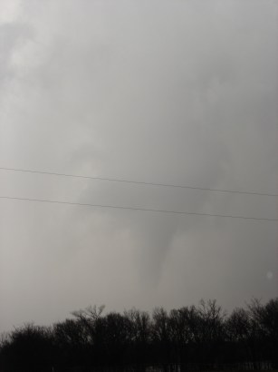
(Left) Photo taken by Nic Wilson 3 miles north of the I-40 and Highway 75 junction near Pharoah, OK at 2218:30 Z
©2005 Nic Wilson Contact the webmaster at nwilson@ou.edu
|
 Eric Holtaus and I
chased eastern Oklahoma on March 21st. Check out our
Eric Holtaus and I
chased eastern Oklahoma on March 21st. Check out our