06.02.05 Eastern Colorado Supercells
Storm reports encountered on the chase:
2237 6 S WOODROW WASHINGTON CO398910358 (BOU) -- Had to go north and missed it by 4 minutes due to road construction! grrr
Chase Account
I was able to sneak out of NCAR around noon for my first Colorado chase. Nice wind profiles and strong instability awaited me in the high plains as I headed east on HW 36 out of Boulder to connect up to I-70 out to Limon to check data. Cumulus was beginning to build over the foothills as I departed, not realizing at the time that this was the birth of the convection to come later in the afternoon.
I arrived in Limon around 2pm and found wifi at the Tymes Square Hotel off of exit 359. A check of radar saw the storms over Denver were beginning to increase in intensity so I made the decision to wait it out until they neared Limon so I would have a good idea of which cell to target. By 3:30pm I had my eyes set on the strongest cell which was beginning to show supercell characteristics in Adams Co. I packed up the laptop and set on north for the half hour drive to Woodrow where I planned to intercept the cell, about 50 miles north of Limon.
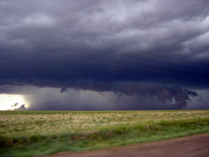
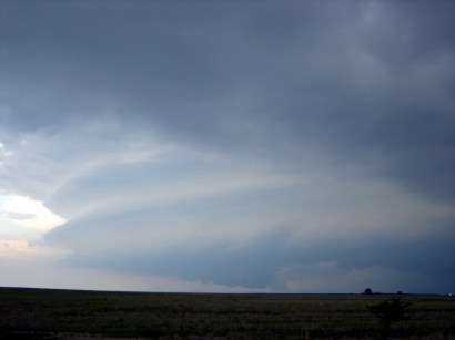
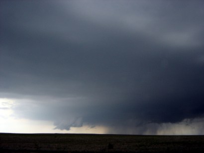
Around 4:20 pm I neared Last Chance, CO and could began to get visual on the RFB to the west of HW 71 and 5 miles or so north of HW 36. Scud and a nice lowered base tempted me to head further north as it suprisingly looked close to dropping a tornado despite still being in a dry low-level environment. As I headed north up toward the meso, south of the town of Woodrow, I noticed some vehicles stopping and lots of heavy construction machinery. Before I knew it I was pulled up behind the ABC 7 Denver satellite truck and chase vehicle along with a couple of other semi-trucks with the meso barreling eastward directly toward us, about a mile to the west with evident rotation. Amazingly, the construction workers were oblivious to the oncoming storm as they trapped us in to allow the opposite direction of traffic to pass through with only one lane open as they resurfaced the road! With no escape route and the meso and hail core looming, I watched the ABC trucks pull over on a gravel road as I floored it north on HW 71 to avoid the brunt of the storm with no way to get back south to track it east due to the construction. Click here to see what happened to the ABC Denver news crew as they rode out the storm on the gravel road.
View of the mean looking meso at 22:33z as I am stuck in road construction, five minutes later a tornado was reported with this storm
Due to the poor road network and my reluctance to drive on gravel roads I tracked north 30 miles to Brush, CO and went east to attempt to get back ahead of the massive HP supercell. Once east 20 miles in Akron I was making good progress to get out to Yuma and shoot back south ahead of the meso, but one lane road construction got in my way again. Instead of waiting 15 minutes I decided to core punch and head south on HW 63 thru Washington Co. I could see the meso out ahead of me still to the southeast and braced myself for the large hail to come. Thankfully once 6 miles north of HW 36 I came across the backside of the hail core with just a few pea sized hail stones. It turned into a winter wonderland quickly as I had to slow down to 30 mph to wade thru the 4 to 6 inches of hail accumulated on the road.
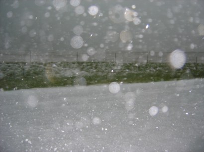
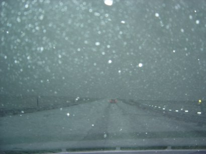
View of the winter wonderland along HW 59 at 23:55 z as I headed south to attempt to catch back up to the meso beast
After reaching HW 36 and heading east toward Cope I soon realized that it would be near impossible to catch up with the HP beast as it accelerated eastward. The rain was coming down in torrents and random hailstones motivated me to head back west to HW 59 and go south to I-70 and call it a day. On the 26 mile drive south to Seibert I began to notice another supercell off to the southwest with an evident lowered base. I continued south and pulled over at a gas station at the I-70 interchange where I met some meteorology grad student from Univ. of Wyoming, one of which happened to know the British exchange students at OU thanks to his days at Univ. of Reading -- small world! We watched the supercell as it headed southeast from Flagler. The meso structure was very impressive for the first five minutes but it soon gusted out. The rapidly approaching squall line of merged supercells urged me to head further south to avoid the brunt of its wind and hail so I took off down HW 59 to Kit Karson, CO.
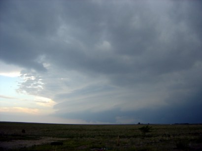
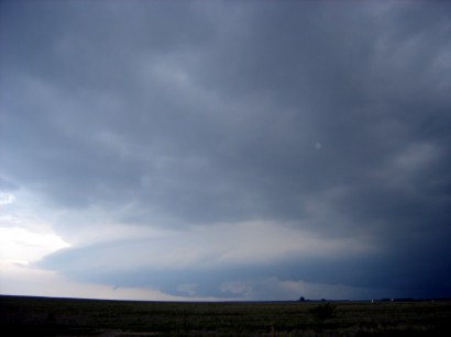
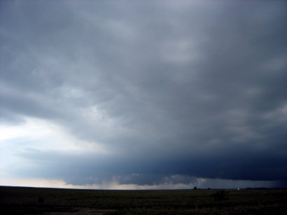
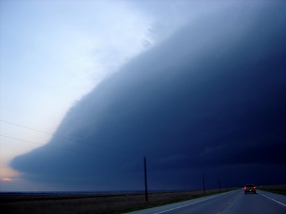
The evolution of the Lincoln Co. supercell from Seibert looking WSW. Pictures taken from 0100 to 0118 z
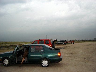
Chaser convergence in Seibert as we all look on at the supercell to the left
Once heading west on HW 40 out of Kit Karson I could see a new updraft pulse going up on the southern end of the squall line...it looked like I was going to get one more good storm before the end of the night.
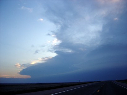
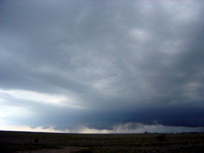
Left: The new updraft pulse at 0159 z off to the WSW Right: Approaching gust front extending from the southwest to the northeast, a half hour before my encounter with the tornado warned cell near Punkin Center.
After getting onto HW 94 west to stay as far south as possible a tornado warning went out for the storm directly to my west, near Kutch...about 35 miles to the west. The convective core of this storm looked brutal against a pitch black sunset sky as I neared Punkin Center. Cloud-to-ground lightning danced around to my west every second or two and the mesocyclone was a black hole to the northwest. Inflow winds began to kick up to 40 to 50 mph and windblown penny sized hail hit the side of my car as I raced west to avoid the brunt of the supercell. The lightning was in the wrong position to illuminate the meso so I didn't want to mess around with this thing at all. After ten heart-pounding minutes I made it west of the storm around 8:45 pm. The scenic drive through Colorado Springs and back up to Boulder got me home around 11pm.
Once again I missed out on nearby tornadoes, but I was able to get within 3 miles of three tornado warned storms. The lesson of the day is to consult the State of Colorado's construction safety policies because operating heavy machinery was the least of their worries on this day. It was frustrating to not be able to catch up to the HP beast that tracked along HW 36, but I am thankful I avoided the nasty hail cores it left along its path. Not bad for my first chase in Colorado, and a solo one at that!