The model used in this study is a T42L12 version of the FSU Global Spectral Model (GSM) developed by Krishnamurti's lab (Krishnamurti et al. 1988), i.e., the horizontal resolution is of a triangular truncation type with a total wavenumber of 42 and 12 levels in the vertical. The full physical processes were applied for both the forecast model and the full-physics adjoint model (Zhu et al. 1997), including planetary boundary layer processes, vertical diffusion, dry adjustment, large-scale condensation and evaporation, deep cumulus condensation, horizontal diffusion and radiation processes. In the FSU GSM, the model state variables are vorticity, divergence, virtual temperature, logarithm of the surface pressure and the dewpoint depression. The adjoint integration was performed in the vicinity of a basic trajectory derived from the forward nonlinear FSU GSM starting from an ECMWF analysis valid 24 hours before the verification time. The gradients of the 1-day forecast error with respect to the initial conditions are called sensitivity patterns.
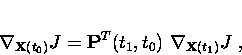
Let us denote by ![]() the state vector of the model at time
t and
the state vector of the model at time
t and ![]() the forecast aspect. Suppose the
time evolution of the atmosphere is governed by the equation
the forecast aspect. Suppose the
time evolution of the atmosphere is governed by the equation
 |
(1) |
 |
(2) |
 |
(3) |
 |
(4) |
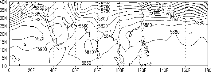
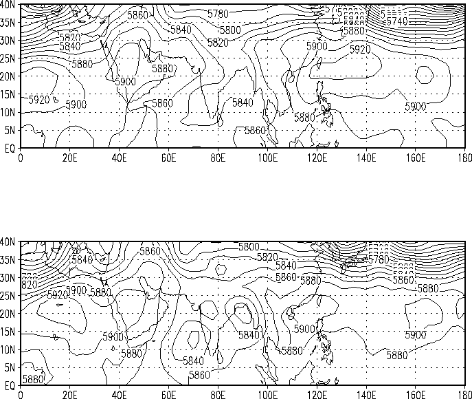
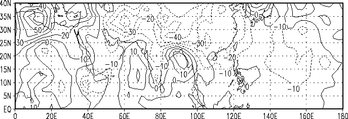
We studied the sensitivity of 1-day forecast error integrated from 12UTC June 7, 1988 over a limited area domain, namely the Indian Monsoon area, with respect to the initial conditions from ECMWF analysis data. The forecast aspect is defined as the square norm of the differences between the model 1-day forecasts and the verifying analysis over the limited area. The limited area or region of interest is defined to be the area between 60E and 100E in longitude, equator and 30N in latitude. A projection operator (masking operator) was applied to obtain the localized model forecast error over the limited area domain. On June 8, 1988, the Indian summer monsoon entered its active stage. A cross-equatorial flow set in, both the Arabian Sea and the Bay of Bengal branches were established, with depressions over the east central Arabian Sea and over the northern Bay of Bengal. Fig. 1 and 2 display the geopotential height fields at 500 hPa at 12UTC June 7 and June 8, 1988 and the model 1-day forecast, respectively. We observe that the depression over the northern Bay of Bengal did not fully develop in the model 1-day forecast. The difference field of the geopotential height field at 500 hPa between the model 1-day forecast and the verifying analysis is displayed in Fig. 3. The differences are found to be rather large over the northern Bay of Bengal around 17.5N.
 |
 |